


The dates for hiking are approaching. The good weather is here again and we must take advantage of it before the temperatures rise like crazy again. Google Maps has a series of keys to hike well and not get lost, as well as being aware of the best routes. Compelling reasons to use the mapping application during your excursions to the mountains or the countryside.
Hiking was previously a risky activity if you didn’t know the area, since you could end up totally lost or disoriented. But with the arrival of apps like Google Maps, things have changed a lot. Today you have a map full of options to hike well and enjoy the adventure to the fullest.
Google Maps options for hiking
On another occasion we already mentioned some of the characteristics that are useful in Google Maps when hiking. Now we are going to focus on those options that you should not forget to enable before starting your trip, so pay attention so as not to miss a single detail.
Activate alerts for forest fires
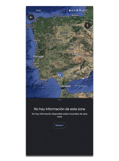
One of the latest developments in Google Maps is related to forest fires. We are living in a time in which the number of fires has increased considerably and no one wants to come across the unpleasant surprise which it supposes. Because of this, Google Maps has introduced forest fire warnings that are very helpful for hiking and not choosing a dangerous route due to the fire or its proximity. To find out if there is a fire in your hiking area, you just have to open Google Maps and select the layers icon that appears at the top right. Inside, select the Forest Fires option and the application will analyze the surroundings.
Select the type of map with satellite view
Google Maps has different types of map views and the best one for hiking is the satellite view. Mainly, because it allows appreciate the paths and details of the map more easily. Just zoom in and you can even see the points of interest along the way to have them as a reference. It is impossible to get lost when using this type of map and this is how you can configure it:
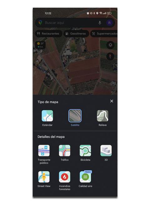
- Open Google Maps on your mobile.
- Select the layers icon.
- Click on Satellite.
Mark key points along the route
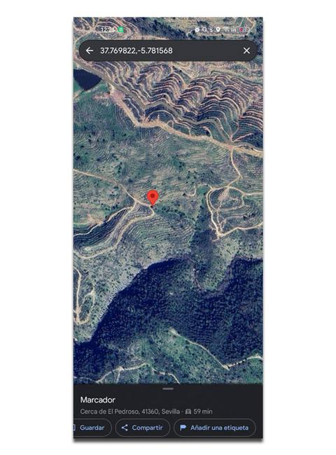

If you have just started a new hiking route and you don’t know it very well, you can always mark the path little by little so as not to get lost or keep it in mind for future occasions. This will allow you to draw a kind of route or fix the most important parts of the path. You just have to hold down anywhere on the map and click on the Add a label option. Enter a custom name and select Save to confirm the process. You can choose the name you want, be it dangerous road, closed route, animals… Everything to obtain more precise information about your route.
Improves location accuracy
When hiking it is important that the mobile GPS works well so that Google Maps can be of use. It is normal that it can fail because on some hiking routes there is hardly any connection, although the app hides a trick to improve GPS accuracy. This feature takes care of detect your location through mobile networks and sensors along with GPS, which increases the quality of the location. These are the necessary steps:
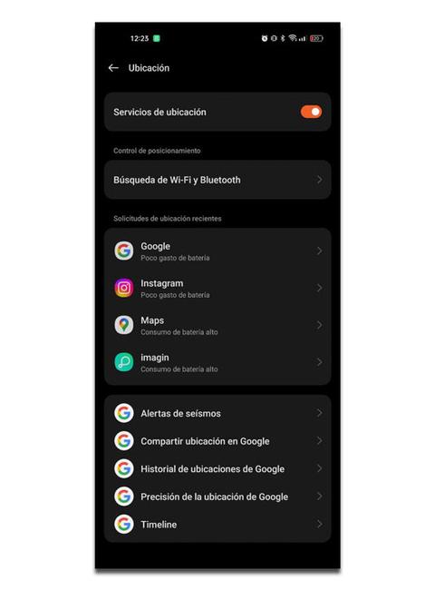

- Access Google Maps.
- Select your profile icon.
- Enter the application settings.
- Click on Google location settings.
- Tap Google Location Accuracy.
- Check the box to improve GPS location.