


Topography, that ancient art of map and measure the earth’s surface, has found in these times an unmatched ally: mobile applications. In the search for precision and ease, the surveyors, engineers and geography professionals They have embraced iOS technology with enthusiasm. These tools not only offer great precision in obtaining topographic data, but have also evolved to integrate advanced functionalities, such as Map overlay and 3D visualizationproviding a complete perspective of the surrounding geography.
In this article, we will thoroughly explore the best surveying apps available on the Apple platformand whether you’re looking for advanced tools or an adventurer who simply wants to explore their surroundings in more detail, these are the most popular options on the market.
Surveying apps: the 8 best to download on iPhone and iPad
- GPS Camera 55 – Photo Location
- 3D Outdoor GPS Maps
- GPS Coordinates Converter
- Avenza Maps
- Tomstrails GPS UTM
- Topo Maps
- GPS Topo
- Commander Compass Go
It’s no secret that the Apple store houses a wide variety of mobile apps, and you can not only get apps for engineers that help you design, build or solve problems, but also useful tools for architects. You will now have access to a list of surveying apps which you can also download on your iOS device.
GPS Camera 55 – Photo Location

Explore the world: GPS Camera 55 captures the moment with photo location
GPS Camera 55 – Photo Location is an application designed for those seeking to document their experiences in a precise and georeferenced manner. With this app, you can add location information to your photos in a simple and efficient way, which is especially useful for professionals such as architects, engineers or field researchers.
In addition to the georeferencing function, GPS Camera 55 offers the possibility of making distance and area measurements on maps. This feature is valuable for projects that require precision in geospatial data collection.
It has decimal coordinate formats, dm or dmscamera and capture settings, notes and commentspreview reduction, drawings and much more.
Its interface is intuitive and easy to use, making it accessible to users of all experience levels. With this app, you can carry a complete record of your expeditions and projectsguaranteeing precision and quality in your work.
3D Outdoor GPS Maps

Unlimited exploration with 3D Outdoor GPS Maps
For adventurers and nature fans, 3D Outdoor GPS Maps is a must-have surveying app in your digital arsenal. This app transforms your iOS device into a 3D navigation tool that will guide you through the most exciting trails and landscapes.
This platform is capable of displaying three dimensional maps, which is perfect for viewing the terrain in great detail, identifying elevations and planning your routes more precisely. Whether you’re hiking, biking, or camping, this app will help you stay oriented.
In addition to 3D navigation, the app allows you record your routes and waypointswhich is useful for carrying a record your outdoor adventures. You can also download maps for offline useideal for remote areas without an Internet connection.
GPS Coordinates Converter
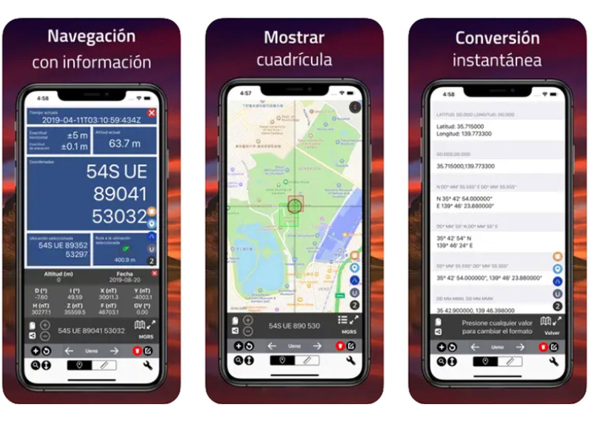
GPS Coordinates Converter: Find your way anywhere in the world
If you’ve ever encountered geographic coordinates in a format you can’t understand or need to convert them for your work, GPS Coordinates Converter is the application that will help you solve this problem.
This is another of the best surveying apps what you can choose to do fast and accurate conversions between different geographic coordinate systems.
Simply place the coordinates in the format you have and select the desired output format and the system will do the work for you.
Avenza Maps

Beyond limits: Avenza Maps connects you with the world
Avenza Maps is another iOS alternative which has been designed for those looking for National Geographic maps, national parks and more for their work or adventures.
This application allows you to upload maps in PDF format and use them for real-time navigation and tracking.
With this platform, you will be able to see maps of hiking, topographical, cycling, urban, nautical, travel and trails. Plus, you’ll be able to add precise location information to your existing maps, which is invaluable for mapping and exploration projects.
And, best of all, the system offers advanced tools such as measuring distance and area, recording GPS routes, adding photos, notes, position marks and much more.
Tomstrails GPS UTM
Discover unforgettable routes with Tom’s Trails GPS UTM
Tomstrails GPS UTM It is a tool that is used to measure land and surveying work from iPhone and iPad. This application focuses on the use of UTM (Universal Transverse Mercator) coordinatesmaking it ideal for engineers, surveyors and professionals who need highly accurate geospatial data.
With this software, you will be able to make precise measurements of distance, areas and elevations. Additionally, the system provides information about your location, which is essential for projects that require a high degree of precision.
Topo Maps
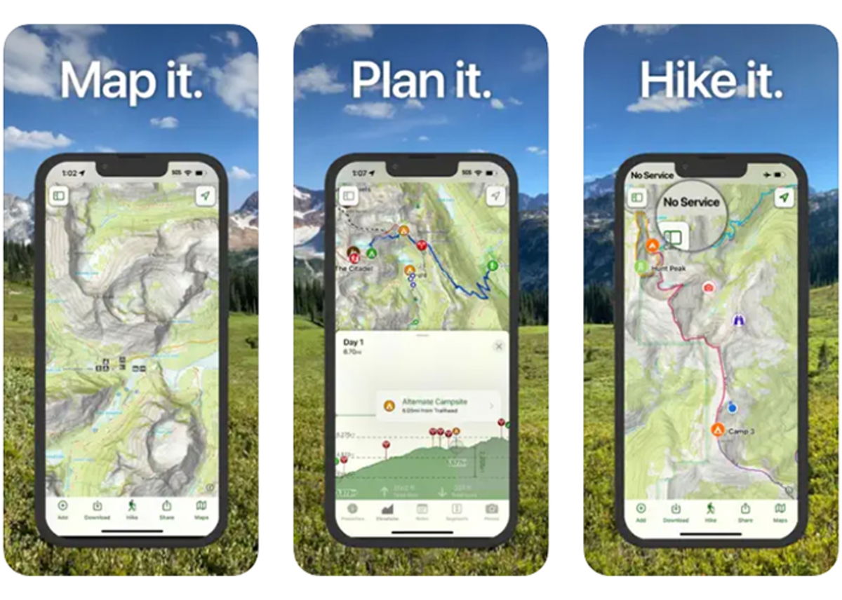
Decipher the terrain: Topo Maps opens the doors of the unknown
If you are a nature fan and enjoy outdoor activities such as hiking, Topo Maps It will become your trusted companion.
This application gives you access to topographic maps details of areas around the world. It also includes planning tools and path tools that you can take advantage of even offline.
The system can display information about elevation, trails and key geographic features. This allows you to plan hiking routes with precision and explore nature with confidence.
GPS Topo
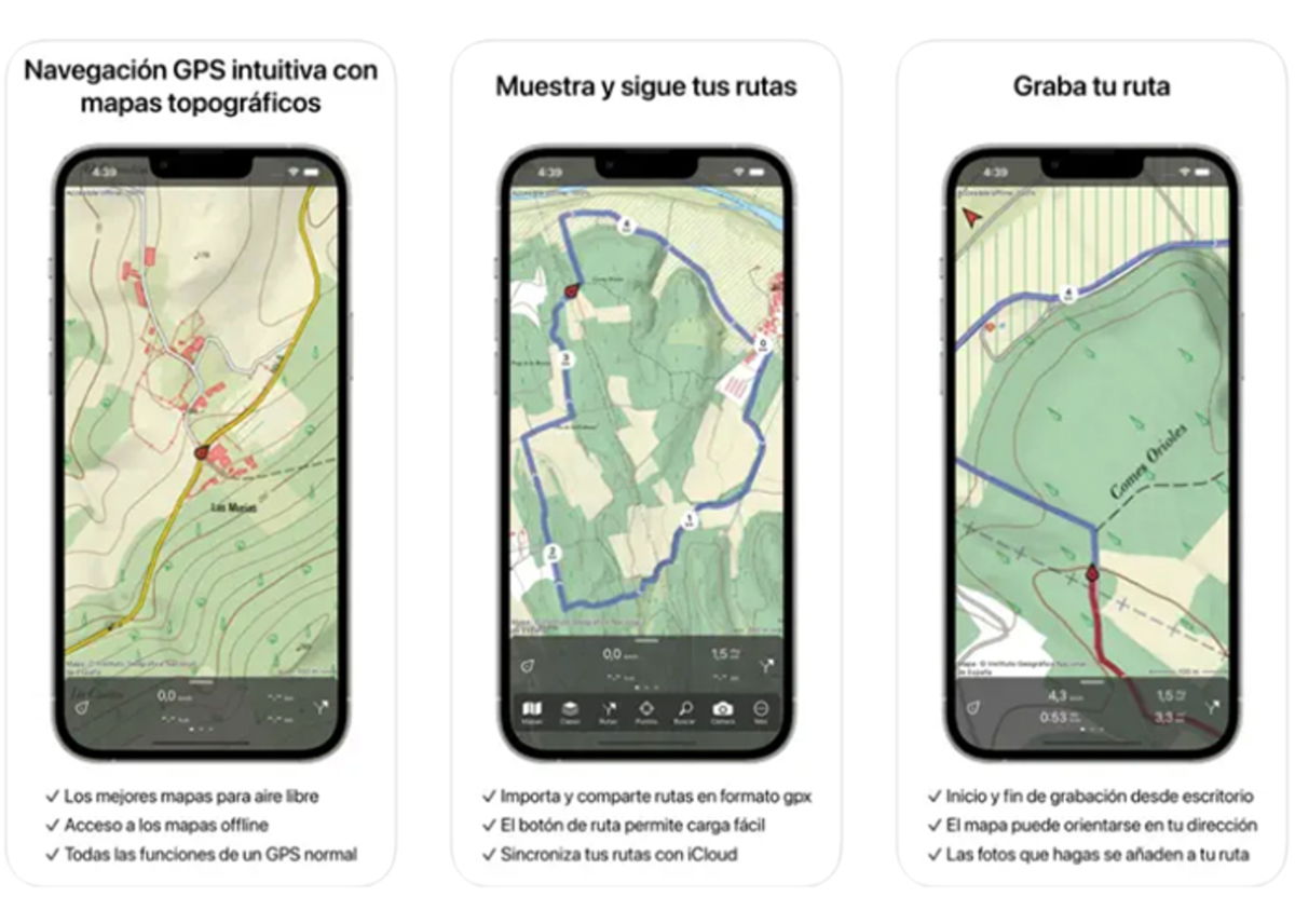
Topo GPS: precise navigation for modern explorers
Another of the best surveying apps available for iPhone and iPad is GPS Topo. It is a pocket-sized tool that combines topographic maps with navigation capabilities. Whether you’re hiking, biking, or driving, this app will help keep you on the right path.
As if that were not enough, this software is capable of providing elevation information and geographic details, which is essential for those looking to explore unknown areas safely.
And, if that were not enough, the system allows you record your routes and waypointswhich is useful for keeping track of your adventures and excursions.
Commander Compass Go
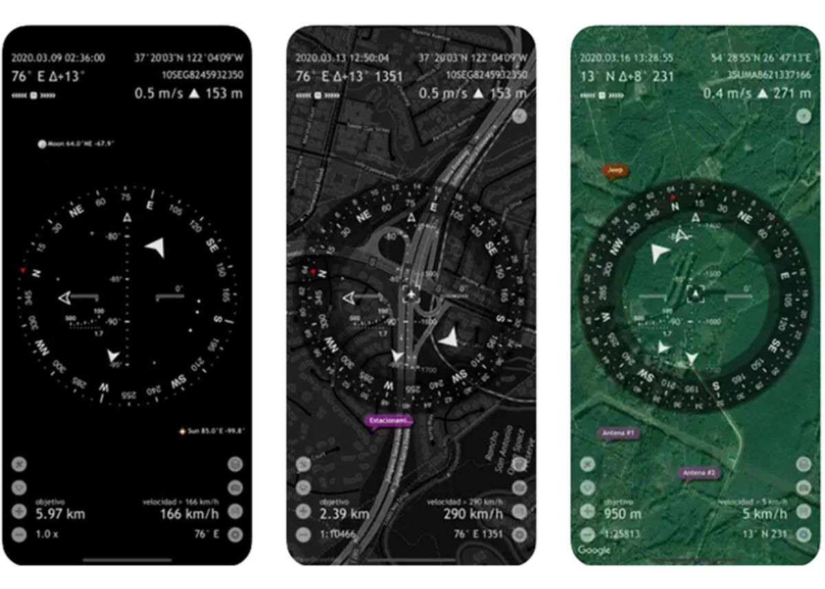
Travel with confidence with Commander Compass Go
If you need a compass and an advanced navigation tool in one app, Commander Compass Go It is the right choice. This mobile platform provides you with real-time information about direction, altitude, speed and location. All this from the comfort of your iPhone or iPad.
Furthermore, it is capable of displaying accurate compass datawhich is essential for orientation in unknown terrain or during activities such as maritime navigation.
And, very similar to other options, it also allows you set waypoints and routesmaking it easy to navigate and track your trips.